Activity
Mon
Wed
Fri
Sun
Oct
Nov
Dec
Jan
Feb
Mar
Apr
May
Jun
Jul
Aug
Sep
What is this?
Less
More
Memberships
Agriculture Mapping School
43 members • Free
1 contribution to Agriculture Mapping School
Jun 10 •
Relative Elevation in Ag
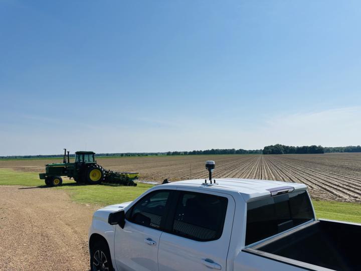
Agriculture Elevation Mapping for irrigation, drainage, and even landforming is all operated off of relative elevation. A base is set on an unknown point around the field being mapped. From there a rover collects elevation or provides a reading relative to the bases location. This practice is commonly used through ground marking/surveying; however with a drone you need real world horizontal accuracy without the need of real world vertical (MSL) which is the common purpose of ground control points (GCPs). The “Hybrid” method as I like to coin it is setting a base location using NTRIP corrections prior to flight with a EMLID receiver or doing a PPK method of processing. How relative can the base be? I’ve collected elevation on over 90,000 Acres across 3 years doing this right here!

0 likes • Jun 11
So you putting a physical base station, or do you measure one GCP on the site with your EMLID ?
1-1 of 1

@julius-petri-7108
Responsible for the mapping software PIX4Dfields at PIX4D. Background in Precision Farming.Self taught Geospatial Analyst & Scientific Programmer.
Active 95d ago
Joined Jun 8, 2025
Berlin
Powered by