
Write something

12d •
The Circular Temple of Pelusium: When Water Became Architecture
A circular temple has emerged from the sands of North Sinai. Not a pyramid. Not a tomb. Not another royal monument built to project the authority of a pharaoh. This discovery is stranger, quieter, and perhaps more revealing. At Tell el-Farama, the site of ancient Pelusium, Egyptian archaeologists have uncovered a rare circular water-centred sanctuary, built around a basin roughly 35 metres, or 115 feet, across. The structure appears to have been connected to a branch of the Nile and surrounded by channels, reservoirs, and drainage features. It was first partly uncovered in 2019 and initially interpreted as a civic or senate building, but continued excavation changed that reading completely. Researchers now believe it was a sacred water installation, possibly dedicated to the local deity Pelusius. That change in interpretation matters. It reminds us that archaeology is not simply the discovery of objects. It is the revision of meaning. A red-brick curve in the ground can look like public seating. A partial plan can suggest politics. A quarter of a circle can become a senate house in the imagination. But when the whole structure is exposed, when the water systems are traced, when the basin, channels, and central pedestal are read together, the building becomes something else entirely. Not government. Ritual. Not administration. Belief. Pelusium itself was no ordinary city. It stood at Egypt’s eastern edge, where the Nile Delta opened towards Sinai, the Levant, and the wider eastern Mediterranean world. It was a frontier city, a port, a fortress, and later a customs station under Roman power. In other words, it was not a quiet provincial backwater. It was a threshold. Goods moved through it. Armies moved through it. Ideas moved through it. Cultures met there, collided there, and blended there. That makes the circular temple especially intriguing. Ancient Egyptian sacred architecture is often imagined through straight lines, axial routes, pylons, courtyards, sanctuaries, processions, and controlled movement from the public world into the sacred interior. But here the central image is not a linear journey inward. It is a circle of water.
3
0
30d •
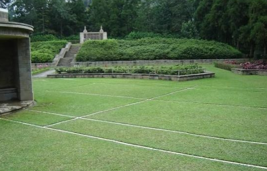
The Battle of the Tennis Court, Kohima, 1944 — The Forgotten Pivot of the Second World War
Most people can tell you what happened on D-Day. Beaches, landings, the beginning of the end in Europe. It sits firmly in public memory as one of the defining moments of the Second World War. Almost no one can tell you about the Battle of Kohima. That is not because it was less important. It is because it happened in a place and at a time that history chose not to prioritise. In 1944, while the Allies were preparing to break into Nazi-occupied Europe, the Japanese launched a major offensive into India. It was a high-risk, high-reward move. If it worked, it could destabilise British control across the region, cut off Allied forces, and fundamentally shift the balance of the war in Asia. The key to that advance was a single road running through the hills of northeast India. Kohima sat directly on it. Not a great city, not a symbolic stronghold, just a ridge that controlled movement. But in war, those are often the places that matter most. When the Japanese advance reached Kohima, the battle did not unfold across wide fronts or sweeping manoeuvres. It compressed. Terrain forced it inward until the fighting centred on a small administrative area around the Deputy Commissioner’s bungalow. And in front of that bungalow was a tennis court. That court became the front line. On one side, British and Indian troops dug in. On the other hand, Japanese forces did the same. The distance between them was so small that neither side could move without being seen, targeted, or killed. Grenades were thrown across what had once been a place of leisure. Trenches were carved through gardens. Snipers watched from shattered positions. At night, the fighting became even more unstable, with both sides probing forward in darkness, trying to reclaim inches of ground that would be lost again by morning. This was not the kind of battle that lends itself to clean narratives. There was no single breakthrough moment, no cinematic turning point. It was pressure. Constant, grinding pressure in a confined space where survival depended on endurance as much as anything else.
Feb 11 •
A 640-Year-Old Castle Found Beneath a Private Mansion. What Does That Tell Us About Europe?
A 640-Year-Old Castle Found Beneath a Private Mansion. What Does That Tell Us About Europe? During excavation work in Vannes, in Brittany, archaeologists uncovered the remains of the 14th-century Château de l’Hermine beneath a private mansion. This was not a loose foundation stone or a decorative arch. It was a substantial medieval structure, once associated with the Dukes of Brittany, now sitting buried beneath later layers of private wealth. Pause on that for a moment. A seat of feudal authority.Buried beneath a modern residence.Not destroyed. Not erased. Simply layered over. Europe does not tend to erase its past. It accumulates it. The Château de l’Hermine was originally constructed in the late fourteenth century as a ducal fortress and residence. Over time, political systems changed, regimes shifted, and architectural tastes evolved. But the land remained. Power changed form, not location. This discovery raises several important questions. First, continuity of land control. How often has land remained in elite hands across centuries, simply adapting to new political systems? When we talk about revolutions and reforms, how much truly changes at ground level? Second, ownership of buried history.When medieval architecture is discovered beneath private property, who owns it?The landowner?The state?The public as collective inheritors of cultural memory? European heritage law often protects archaeological remains, but enforcement, preservation, and public access vary widely. Third, urban stratigraphy as memory.Cities such as Rome, Paris, London, and Istanbul are layered vertically. Every regime builds over the last. Yet we rarely think about the psychological effect of living above buried authority structures. Are we walking across forgotten centres of power every day? Finally, archaeology as interruption.Modern development assumes forward momentum. Archaeology interrupts that narrative. Every excavation reminds us that progress sits on foundations we did not build and rarely fully understand.
Mar 8 •
The Dead Landscape: What 5,000-Year-Old Burial Mounds Reveal About Early Civilisation.
Over the past few weeks archaeologists surveying farmland in central Europe discovered something remarkable. Hidden beneath ordinary agricultural fields were dozens of Neolithic burial mounds nearly 5,000 years old. They were not discovered through digging. They were discovered through remote sensing technology such as LiDAR, magnetometry and aerial imaging. Beneath the soil lies an entire funerary landscape. These are known as long barrows, elongated burial monuments constructed around 3000 BCE. They are among the earliest monumental structures in Europe. What makes this discovery particularly interesting is where these burials were located. They were not placed inside settlements. They were placed outside them. This suggests something fascinating about how Neolithic people conceptualised space. The living and the dead existed in separate landscapes. The burial mounds were also highly visible monuments. When newly built they would have stood prominently on the horizon, marking territory and ancestry. In other words, they were not just graves. They were statements. Statements of land ownership, lineage and identity. Many archaeologists now believe these early monuments helped communities create collective memory. The dead anchored people to the land. You were buried where your ancestors were buried. And that made the land yours. Yet we are only discovering these landscapes now because modern technology allows us to see what traditional excavation could not. For centuries they were simply invisible beneath farmland. Which raises an interesting question. How much of human history is still hidden beneath ordinary landscapes? Questions for the community: What do you think these burial monuments were primarily about? Memory Religion Territory Power Why do you think Neolithic communities separated the world of the dead from the world of the living? And perhaps the bigger question: If technologies like LiDAR are revealing entire hidden landscapes, how much archaeology is still waiting to be discovered beneath our feet?
Feb 6 •
How Old Are the Pyramids and the Sphinx? A Radical Claim and the Evidence Behind Every Theory
Most people are taught a simple answer to one of history’s biggest questions: the Great Pyramid of Giza was built around 4,500 years ago as the tomb of Pharaoh Khufu, and the Sphinx belongs to the same Old Kingdom building programme. That explanation isn’t invented and it isn’t weak, but it also isn’t the only one that exists. The article below makes a much more radical claim. It suggests that the Great Pyramid may be vastly older than the accepted timeline, possibly tens of thousands of years old, based not on texts or archaeology, but on erosion analysis. Whether that claim turns out to be right or wrong is almost secondary. What matters is that it forces a better question: How do we actually know how old the pyramids and the Sphinx are, and what evidence are different theories really relying on? This post uses the article as a conversation starter, then expands outward to look at every major theory about the age of the pyramids and the Sphinx, from orthodox Egyptology to the most extreme alternatives, and the strengths and weaknesses of each. https://allthatsinteresting.com/when-was-the-great-pyramid-of-giza-built The mainstream position places the construction of the Great Pyramid in the 4th Dynasty of the Old Kingdom, during the reign of Khufu, roughly in the mid-third millennium BCE. This view isn’t based on tradition or assumption. It rests on multiple independent lines of evidence. Administrative papyri discovered at Wadi al-Jarf describe the transport of limestone from Tura to Giza during Khufu’s reign and reference a project widely identified as the Great Pyramid. Radiocarbon dating of organic material found in mortar and construction debris consistently falls within an Old Kingdom timeframe, with known offsets explained by the reuse of older wood. The wider archaeological context matters too: causeways, temples, worker settlements, and quarries all form a coherent state-run building programme rather than a monument inherited from the distant past.
1-10 of 10

skool.com/the-worldmind-society-1949
Welcome to a community for people passionate about history, archaeology, philosophy, and cultural ideas. Join deep discussions, share perspectives.
Leaderboard (30-day)
1

+2
2

+1
3

+1
4

+1
5

+1
Powered by